How to get to Paraiso de Miguel
Paraiso de Miguel is located about 25 miles west of Golfito on the beautiful South Pacific Coast of Costa Rica. Golfito is located on the Osa Peninsula 210 miles (339 km) from San Jose.
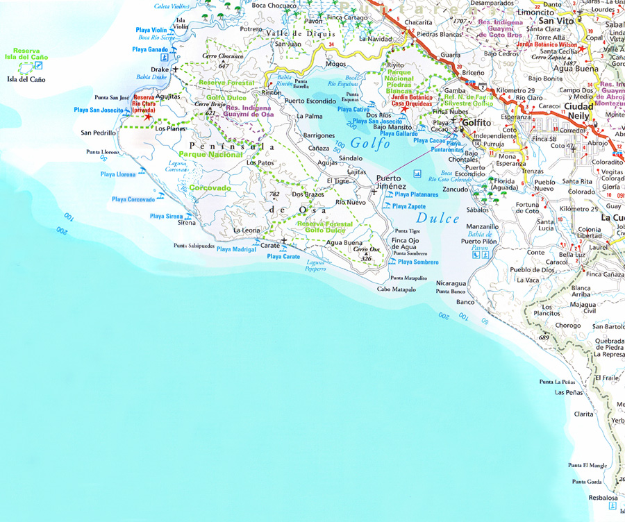
Please take a look at the map of Southern Pacific Region of Costa Rica.
Transportation assistance available - Please inquire
Directions to the property
From San Jose: (6.5 hours from San Jose)
Take the Pan-American Hwy south to the town of Rio Claro. When entering Rio Claro, turn right at the Banco National office. There will be a sign on the corner that says Golfito. Turn right and travel 10 kilometers till you get to a 3-way intersection. At the intersection there will be a sign that says Rio Coto Ferry 9 km/Conte 26 km. Turn Left and travel 9 km to the Rio Coto Ferry.
From Golfito: (55 minutes from Golfito)
Exit the airport and follow the road out of Golfito toward Rio Claro. 11 km from town you will reach a 3 way intersection. Turn right toward the Rio Coto Ferry. At the 3 way intersection turn left - follow sign that says Conte 26 km. You will travel 9 km until you arrive at the Rio Coto ferry.
From Rio Coto Ferry:
After exiting the ferry, travel 4 km, then take a right at the intersection following the signs that say Pavones. You will come to a very narrow bridge shortly after the turn. Travel an additional 11 km and you arrive in Conte. There will be a cantina on the left and a grocery store on the right. Turn right towards Pavones. 2 km further down the road you will approach a fork. Stay left to Pavones. In 4 km you will pass Cuervito School, which is on the right side of the road. Continue for another 400 meters and you will arrive at the entrance to Paraiso de Miguel. A white corral fence borders the property. Once you enter the property merge left up the drive to the duplex on the top of the hill.
Enjoy the breath taking view. You have arrived in paradise!